How places are marked
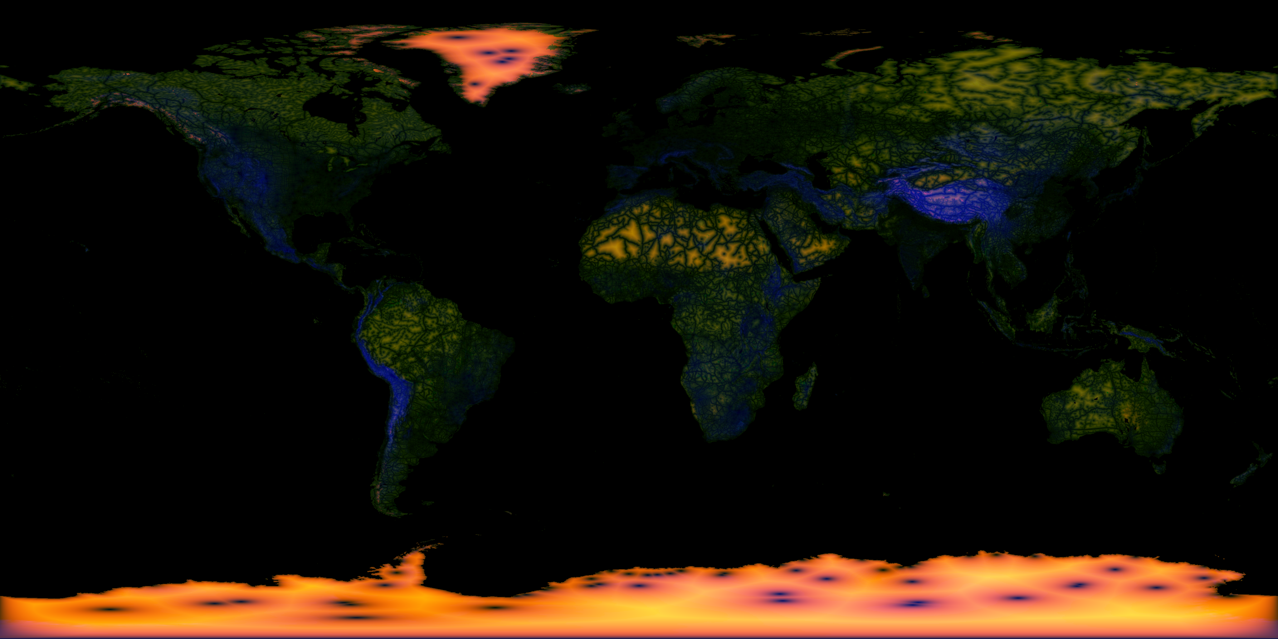
What turns a place orange
Two things. It is far from every way in, and the ground is somewhere people could not
live.
A way in is a road, track, railway, town, airstrip, research station, mine, archaeological
site, river or coast. The map measures how far each patch of land, about 10 km across, is
from the nearest one. Around 100 km off counts as far. Past 300 km it hardly gets more
remote.
What holds a score down
Ground people have used for a long time. Ice can reach 100, because nobody ever lived on
it. Open desert and very high country stop near 75. Forest, grassland and tundra stop near
55, because people have lived on or crossed that ground for thousands of years. Lights at
night pull a score down further.
Why each region looks the way it does
-
Antarctica is almost solid orange. It is ice, it never had a native population, and the
stations are small dots on a continent.
- Greenland is orange inland. People live on the coast and the middle is ice sheet.
-
The Sahara and Arabia are patchy. The big dune seas are far from any track, but nomads
crossed them, so they are capped.
- Tibet has some orange. It is high and far from roads, but herders use it.
-
Siberia and Arctic Canada show orange only on remote mountains and islands. Hunters
ranged widely everywhere else.
-
The Amazon is barely marked. Rivers reach nearly all of it and people have lived along
them for thousands of years.
-
Australia is mostly unmarked. Tracks cross the deserts and people have lived there for
tens of thousands of years.
The evidence check
The score is a guess from distance. When you tap a spot, the page also asks four public
sources what is on record within 10 km: photos, wildlife records, iNaturalist sightings
and Wikipedia articles. If any come back, somebody was there, whatever the score says.
Where it is wrong
Nobody keeps a record of everywhere people have stood. The map only knows the camps, mines
and expedition routes that are in its data, and some are missing. Hunters, herders and
nomads went far beyond any road. The oceans are not scored.
Sources
-
Natural Earth: land, roads, rivers, ice
-
Malaria Atlas Project: travel time to cities
-
OurAirports:
airstrips, open and closed
-
COMNAP: Antarctic stations
-
Wikidata: mines
and archaeological sites
-
GeoNames: towns
of 1,000 or more
- NASA: night lights
-
On tap:
Sentinel-2 cloudless by EOX
and NASA Blue Marble pictures, Wikipedia, Wikimedia Commons, GBIF, iNaturalist,
Open-Meteo, OpenStreetMap search
Code on GitHub